Current Time On The Rock

Showing posts with label Sun Rises. Show all posts

Monday, March 17, 2008

"Sunrise, St. John's"

 
A beautiful sunrise in St. John's. Have a great day. We are going to have another storm. Two in three days. New logo should be ready on Tuesday and Tuesday pool session to look froward to and of course....more shovelling.
Posted by Picasa

Friday, February 29, 2008

"Early In The Morning......"


Buoys are useful for many things and though this is a mooring buoy it could otherwise have been used to indicate the direction of current flow or even to calculate the current speed. This day though there is zero current and actually there is at most times in the Avalon Peninsula area of NFLD, little current to paddle in. Tide differences from high to low is about 0-1 meter. Though currents can be useful, (horizontal coastal currents) for moving you along, in wind, against you, they can be a pain in the ......kayak seat. This was an early morning paddle at about 8 am in early Feb. 2008. This shot is around Blow Me Down, NFLD looking across Conception Bay to St. Thomas....Portugal Cove due East, about 24km away.......as the Gull flies!

Saturday, February 02, 2008

"Coast Gaurd"

 
There is a Coast Gaurd vessel slowly making it's way around St. John's Bay. From Signal Hill she appears to be basking in the beautiful sunrise. I would have loved to have been out there in this sunrise but was on my way to work. Feb.2nd, 2008.
Posted by Picasa

"This Morning"


St. John's harbour provides a beautiful backdrop for some amazing sunrises. Feb.2nd, 2008. Up and at it early today.
Posted by Picasa

Friday, February 01, 2008

"Bareneed, NL"

 
This is my put-in site at 0730h on Feb.1st, 2008 for an approx. 4 hr paddle up the Port de Grave Peninsula. Should have been 3 but there were strong head winds coming back. The day started out very sunny and remained that way for the whole of the trip. The winds varied the whole way but definitely picked up upon my return.
Posted by Picasa

Monday, October 08, 2007

Friday, May 12, 2006

"The MIghty Peace", Fort St. John, BC


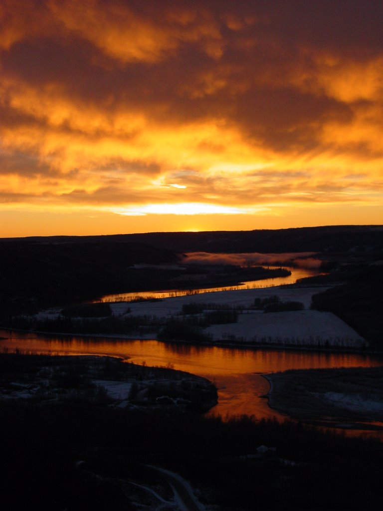
A cool early morning walk gave me this amazing sunrise. The sky was burly and rough and looked like it was almost acrid with a flowing river of copper below. The weather however was cool and crisp with a dusting of snow on the ground.

This is the Mighty Peace River. It is the one Alexander MacKenzie, the surveyor, paddled on his way to the Arctic. I kayaked parts of this river in both an ocean kayak and a little river runner as there are some standing waves at different times of the year worth playing on. There are also groomed campsites on islands all along its course which is a fairly long one. The Peace River region is vast, reaching over 12,000 kilometres from Summit Lake to its confluence with the Slave River.

It was the home of the earliest people, the Clovis and Folsom People, who lived and traveled in the Peace River region over 11,500 years ago.
The First Nations tribes have had a long and proud history in the Peace River from times before recorded history through the fur trade years and into the present. The Métis formed as a unique people in the Peace River region and continue to contribute to this day.